'Annapurna
circuit trek' is one of the most sought after by trekkers. In general, it
starts from Besisahar, the
headquarter of Lamjung district and
ends in Beni, the headquarter of Myagdi district. We completed the trek in
a different way, with a lot of thrills!
Taking the opposite route!
The
festival of Dasain was in its usual
pace. On the evening of September 24, 2009, we drove to the new bus park, Gongabu, to catch a night bus to Besisahar. There was a huge crowd of
people, all set to travel to their homes for the festival. 'We have been celebrating
Dasain exactly the same way for many years.
Why not celebrate it in a different way, by exploring different places in
Nepal?' this simple realization had driven me for the trek. In the bus park, we
were informed that no night bus leaves for
Besisahar from Kathmandu. We were not in the mood of waiting for the next
day. So, we took a night bus to Beni.
All the available seats had already been occupied; we were compelled to travel
sitting on the stools placed in the middle row of the bus.
Risky road to Jomsom!
Travelling
such a long distance on a stool was evidently going to be difficult. After the
dinner, we climbed to the hood of the bus. We felt more convenient up here and enjoyed
the cool night breeze hitting our face. In no time, we fell asleep. At 03:30, a sudden drizzle awakened us, while
the bus was running through Pokhara. However, we managed to cover ourselves by
the tarpaulin put to
cover the bags of all the fellow passengers.
At
Beni, we took a jeep to Ghasa (border between Myagdi and Mustang districts). The motorable road had been opened very
recently; it looked quite risky. While the rough and muddy surface of the road
vividly exposed the challenge we would have to go through, the thundering Kaligandaki river injected a strange
fear in us as we were travelling such a road for the first time in our life. We
got down near the Rupse chahara. The
magnificent fall added a charm to our adventure seeking souls. We did look for
the Kaligandaki gorge, the deepest gorge
in the world. But we could not be sure of the exact location, due to the lack
of an information board. The next morning, we took another jeep to Jomsom, the headquarter of Mustang. The
ride was less challenging than the previous day. However, it was dreary due to dusts
that accompanied our jeep most of the times.
 |
| Jomsom bazaar |
An informal
pilgrimage!
At
Jomsom, I noticed a small apple
orchard just nearby the bus stop. The lack of an opportunity to taste apples at
Marpha (the apple capital of Nepal) was
almost eating up my mind. In no time, I climbed the wall and picked some
apples. Nobody took notice of this except for the Nilgiri himal, that waved smiles at me on the south. To us who were
used to seeing the Himalayan ranges to the north, finding them in the south
clearly indicated that we were now beyond the Himalayas.
Jeeps were available at Jomsom that would take us to Muktinath. But our legs were craving for
a walk. We passed the stone paved road of Jomsom bazzar and headed towards Muktinath
by crossing the wooden bridge over Thakkhola,
(the name by which Kaligandaki river is
called between Jomsom and Ghasa). Soon we were walking on the
sandy bank of Kaligandaki. The
surrounding hills were almost bare; few Caragana
and Seabuck thorns (Hippophae sp.)
added a little greenery however. As we were walking the bank of Kaligandaki, our bodies felt strong
blows of wind. The wind was so strong that small pebbles were being blown off
the surface. At some moments, it even shacked my body! We exchanged fantasies
and started to sing aloud, 'Jomsome
bazzarma, bahra baje hawa sarara…'
After
about four hours we reached Kagbeni.
We walked through the stone walled lanes that added an interesting look to the
area. A few people were performing post-death rituals (Shradda) of their deceased relatives on the bank of the Kaligandaki river, driven by a strong
belief that performing Shraddha at Kagbeni ensure the attainment of Nirvana
to the departed souls. We took less interest in them, but remained amaze ridden
looking at the erosional features shaped by wind over millennia on the
surrounding hills. The buckwheat continued to display their natural dance on
the nearby fields.
.JPG) |
| Kagbeni |
At
Jharkot, few stands of Himalayan poplar (Populus ciliata) boasted of being the sole representative of the
tree community in the region.
 |
| Jharkot |
Near the gate of Muktinath temple, vendors were selling ammonite fossils. For the
religious community, these fossils are a form of Bishnu, the God of protection (Muktinath
temple houses this God); to us they were a proof to the fact that the land of
Nepal was formed by the uplifting of the Tethys sea. Various ammonite fossils
have been displayed in the Mustang Eco-Museum in Jomsom.
 |
| Ammonite fossils in Mustang Eco Museum, Jomsom |
The
fossilized stones were priced at the range of NPR 200+; the better the fossil
shape, the higher the price. Although I am not religious by nature, I did buy
two stones for my mother who would be disappointed if I did not take them
along. In the older days, people used to find a lot of these fossils from the
bank of Kaligandaki. But these days,
it's a rare find here. So, they bring them from Damodarkunda in upper Mustang
leading to a significant increase in price.
At
Muktinath, we were welcomed by a
board that read, 'Plastic bags are prohibited!' All of us performed general
worshipping and headed to the temple of Jwalamai,
where a natural flame has been burning since a long time. To me the flame was
presenting a query, 'Does it not represent the possibility of having fossil
fuels here? The ammonite fossils and this flame; try to establish a link!'
 |
| Muktinath temple |
After
about two hours of leaving Muktinath,
greenery appeared in the form of dwarf junipers, Juniperus horizontalis. While we were taking rest by a stone on the
alpine meadow, a couple came and explained to us, 'Guys, you are sitting nearby
the Bishnuchulo. Legend says that
once Bishnu, the God in Muktinath got angry with his wife, the
goddess Laxmi, and came up here. He
spent a few days here and used this stone as stove for cooking food!'
At
about 14:00 we reached Phedi. We were
actually planning to ascend the Thorong
La, a pass bordering the districts of Manang
and Mustang at 5416m. But all the trekkers
coming down from the pass suggested us to stop here. 'The wind is fiercer
during the evening and the uprising hot air creates oxygen deficiency near the
surface. It is wise if you do not climb today', said a trekking guide. We took
an early stop.
Trekking in the
dark!
Our
spare time at Phedi passed by playing
cards. We had a candlelight dinner and slept early with a plan to get up at the
middle of the night and ascend towards Thorong
La. While we were sleeping, our ears caught the sound of rain. We got up at
03:00 in the morning and started to ascend. The denser cold air remained near
the surface in the morning providing more oxygen. At the same time, the wind
was also feeble. For an hour or two we ascended in complete darkness, with our
torchlight providing very faint light. The slope was very steep but darkness
helped us lower the fear since we did not have a clear view of the slope. All
of sudden, sunlight sprinkled its cool touch on our face and soon the Himalayas
began shining all around. The moment almost touched a chord in my heart. We screamed
to the top of our voice to set our body free from the fascination that had held
us captive. A short while later we were walking on snow. To keep our body warm,
we chewed garlic pods and to replenish the fluids lost while ascending, each of
us had two bottles of electrolyte mixed drinking water.
We
moved up with Nilgiri himal almost at
a standoff distance. The footprints of wild ungulates, carved on snow,
fascinated us. But, we felt bad to see
trash mainly in the form of plastic bottles all over the trail. After a tiring
ascent of six hours, we reached the Thorong
La at 09:00. It was extremely cold. The excitement of finding ourselves at Thorong La urged us to take pictures.
Sadly, the camera batteries had completely exhausted and we had no spare one
either. However, we managed to take a few pictures by inserting the memory card
of my camera into the camera of a British trekker. Thanks to him for the
generosity. Everybody was gathered inside the only tea shop run by Aaitaman Gurung. Every sip of the tea
was adding warmth to our cold body. While we were having tea, it began to snow.
Thorong La was painted in natural
white in a few minutes.
 |
| At Thorong La |
Having
taken our lunch at the Thorong high camp, we descended down. At Thorong base
camp, we met a large group of tourists. When we told them that we had come
across the Thorong La from Mustang side, a trekking guide threw an
amazed look at us and exclaimed, 'You guys are crazy. Crossing Thorong La from Mustang side is very challenging. You know, many trekkers return
back from Thorong base camp, being scared of the height that has to be gained!'
The next year a group of my friends made this trip following the same route. Sadly,
one friend suffered from altitude sickness en route to Thorong La. However, they were lucky to avoid a mishap. 'Dear
reader, please do not attempt Thorong La
from the Mustang side. We had to do
it because time presented us no other option!'
For
that night, we halted in Manang
village.
 |
| Manang village with Gangapurna lake in the middle and Tilicho peak in the backdrop |
To Tilicho through the landslide area!
Going
to Tilicho lake was not on our plan.
But I proposed that we visit it anyway. While Bishwo and Rina instantly agreed,
Anil was not interested. He was feeling too tired for another ascent. Few hours
passed in discussion but the dice turned to my favor and we tightened our boots
to head towards Tilicho, the highest
lake in the world.
We
took leave of the beautiful Manang village
and followed Marsyandi river. Gangapurna lake was lying calm on the
other side of the trail. But we took almost no interest in it as our minds were
completely occupied by the zeal for Tilicho
lake.
The
landscape of Manang exhibited a
contrast to that of Mustang in terms
of vegetation. On a similar elevation, Mustang
was treeless, while there were numerous species of trees including Pinus wallichiana, Betula utilis, Tsuga
dumosa, Abies spectabilis, Picea smithiana among other in Manang. We followed the trail and passed
Khangsar to reach Shereekharka, where a single hotel was
waiting for us for lunch. After the meal, we busied ourselves in cutting some
twigs to prepare our trekking sticks, since we were informed that the trail
ahead was very risky and passing it without a stick is very difficult and
challenging.
A
little ahead of Shereekharka, the
trail divided to upper and lower trails, both of which would meet near the
Tilicho base camp. The lower trail would take less time but we had to pass a
landslide area stretched to almost half an hour distance. On the other hand,
the upper trail was comparatively safe but would take almost two hours more
than the lower trail. But it would also pose a threat of altitude sickness as
we were to gain altitude again. We decided to take the lower trail.
 |
| The lower trail to Tilicho lake |
A
very challenging trail lied ahead. With sloppy terrains up and down, the trail
had space no wider than to hold two legs. To make things worse, the loose
pebbles falling down with almost every step, added to the challenge. There was
no margin for error. Else we would fall straight down to the Marsyangdi river. We had to take very
careful steps and give attention to the terrain uphill, as small or big stones
were possible to roll down any time and we could hardly make sure that they would
not hit our timid bodies. After about 30 minutes, we sighed with relief. My
heart raced with fascination to see a herd of blue sheep grazing near the
Tilicho base camp. A lot of tourists had gathered near the 'Tilicho Base Camp
Hotel' the only hotel present at that time. It was certain that this single
hotel was not going to accommodate all the visitors. To our good luck, we got a
room to spend the night; otherwise we could have been put to spend the cold
night in the dining room!
The
next morning, we got up at 05:30, the latest of all and headed to the Tilicho lake. A very useful tip of a
trekking guide brought ease to our ascent. He told us, 'Guys, do not haste. You
are going fast when there is excitement in you and then stop as you get
completely tired. This will eventually make you too weak to advance further.
You know, you have to catch a rhythm while you go up. Please go slow, in a
fixed rhythm and do not take too much of rest. Even if you feel like, don't sit
or lie down, rest simply by standing. Drink adequate fluids. Then you will make
it to the lake easily!' We took his advice sincerely. Surprisingly we became
the first to reach the lake! From 4150 m at the Tilicho base camp we reached
the Tilicho lake at 4920 m, in two
hours and forty five minutes. Standing in front of Tilicho lake, we felt as if time had paused for a few minutes. We
were speechless, fascinated by the reality of being by the highest lake in the
world. We spent a few hours alongside the Tilicho
lake building many stone towers.
 |
| By the Tilicho lake |
Into the apple
orchard!
While
descending down from Tilicho, we were
in a hurry, as we wanted to reach as far as we could for the night. We managed
to get back to Humde where we got
entertained by the cultural performances by the ex-students of Lophaling
Primary School. They danced to the Tibetan and Indian songs, collected some money
and donated them to their former school. What an endeavor!
The
next morning, we gave a quick look to the Humde
airport and headed further. At Bhratang,
we came face to face with a huge apple orchard. I could not keep myself from
entering the orchard and pick a bag full of apples. While I was picking the
apples, I was filled with the fear of getting caught. But nothing happened as
such! When we had left the orchard and were more than 100m far, I cracked a
joke, 'Guys, today I realized why the stolen fruits are so delicious! It's
simply because you require a strong will power to get into the act and it
involves so much of hard work!'
In the district of
my hero!
We
came down through Chame, the
headquater of Manang district. Its
outlook was not worth calling it a headquarter, when compared to Jomsom. Further down, we came past the
farms of buckwheat, millet and wheat. I vividly noticed the decrease in the
number of dustbins with the descent. At Tal
village (the border between Manang
and Lamjung), a tourist guide
expressed an immense happiness to see us as tourists since it's very rare to
see Nepalese coming as tourists exploring their own country. Most of the
Nepalese one meets on this route are either trekking guides or porters.
 |
| Tal village |
On
reaching Lamjung, I became too
emotional as I remembered late Dr. Harka Gurung, who was brought up in this
very district. Frankly, it was his book 'Vignettes of Nepal' that drove me into
exploring the Himalayan landscapes of Nepal. He is my hero and I silently paid homage
to his departed soul. At Syange, we
took a jeep to Besisahar.
Motorable road versus
alternate trekking trails
Today,
Manang and Mustang have changed remarkably in terms of the road network. Buses
go up to tManang village now. Similarly,
jeeps take you up to Muktinath in Mustang. The roads have certainly
brought ease in the livelihood of the villagers but unfortunately, benefit from
tourism has dropped considerably in places like Tal and other intermediate villages. In 2009, I was worried to
have completed the circuit in just nine days. In 2013, it seemed to me that now
it is even possible to complete in just a week. However, I am relieved to hear
that an alternate route has been completed from Jomsom to Tatopani. To
my pleasure, I observed the alternate route to Jomsom from Muktinath via
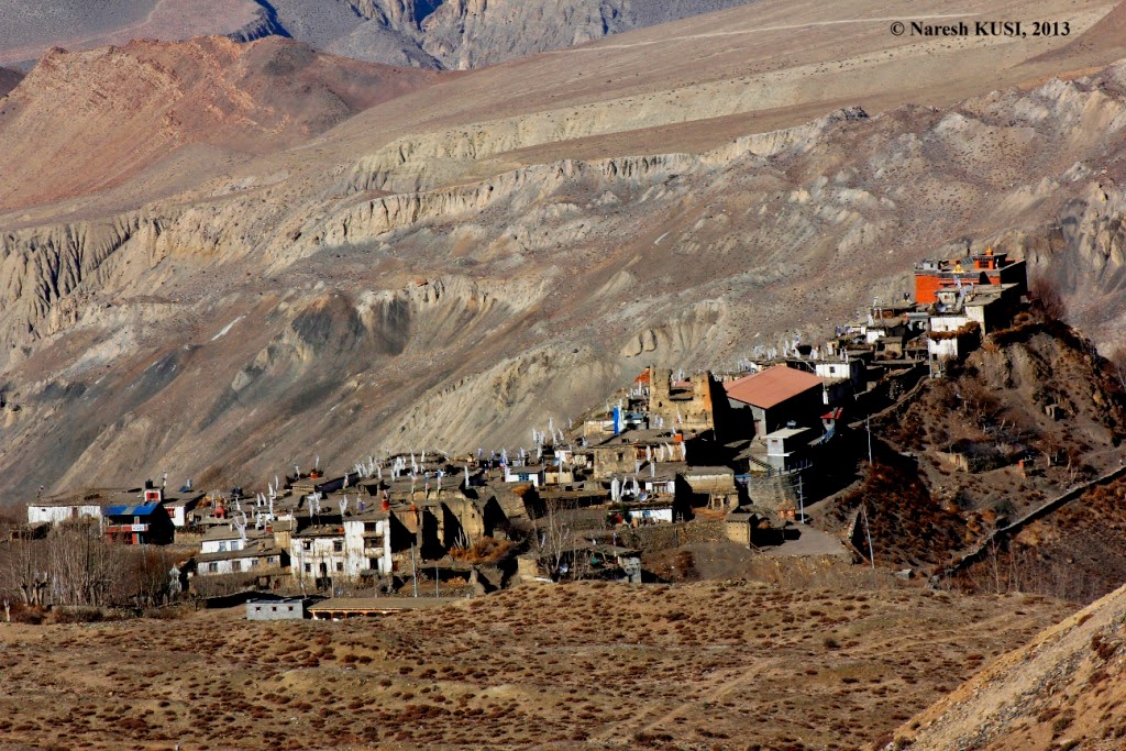
Lupra; with the section from Lupra to Jomsom remaining to be completed.
 |
| Lupra |
An alternate route seems to have
been in progress in Manang as well. I
have a great hope to see tourists trekking in the Annapurna circuit through the
alternate route and spending more days in the landscape! Trekking through the
dusty motorable roads is not worth the experience!
